Mont Ventoux by bike: 3 reference climbs
The Giant of Provence draws cyclists from around the world, but each side has its own character. After dozens of climbs and conversations with enthusiasts who stay with us, here's the complete guide to the three Mont Ventoux ascents: profiles, challenges, practical advice, and what nobody tells you before you set off.
Mont Ventoux by bike: myth, challenge, and three ways to suffer
The Giant of Provence rises to 1910 meters and attracts thousands of cyclists each year who come to challenge its slopes. After hosting dozens of enthusiasts in our Avignon apartments and hearing about their climbs—successful or abandoned—we’ve compiled this complete guide to the three legendary sides: Bédoin, Malaucène, Sault. Here’s what you need to know before you set off.
The three climbs: profiles and characters
Bédoin: the legendary reference (and the hardest)
Profile: 21.5 km, 1610 m elevation gain, average gradient 7.5%, sections at 10-12%.
Bédoin is the legendary climb, the Tour de France one, the one that saw the exploits of Pantani, Armstrong, Froome. It starts gently in the village, then attacks seriously from km 6: 9 kilometers through the cedar and pine forest, with sustained gradients (8-10%) and sections at 12% (notably km 10-11, the famous “Bédoin wall”). Little shade despite the trees, stifling heat in summer.
At km 15, you emerge from the forest at chalet Reynard (only refreshment point, water fountain). The final 6 kilometers cross the lunar landscape: white stones, sparse vegetation, total exposure to wind and sun. The gradient stays at 8-9%, and the summit seems never to get closer. This is where many crack, physically and mentally.
Our take: Bédoin is a rite of passage for any self-respecting cyclist. But it’s also the most demanding climb: irregular gradient, heat, wind, length. If it’s your first time on Ventoux, consider Sault or Malaucène first.
Malaucène: more regular, more shaded
Profile: 21 km, 1570 m elevation gain, average gradient 7.5%, more regular than Bédoin.
Malaucène starts from the north, passes through the picturesque village, then attacks via a wider, better-shaded road than Bédoin. The gradient is more constant (7-8% over most of the route), with fewer violent spikes. You stay in forest until around km 13, which offers some coolness.
The final 8 kilometers join the moorland and final switchbacks common to all three sides. The wind can be violent (mistral from the north), but the regularity of the gradient makes it easier to find a rhythm than on Bédoin.
Our take: Malaucène is an excellent compromise. Less legendary than Bédoin, but more pleasant to climb: better shade, more constant gradient, less traffic. If you want to “do Ventoux” without the torture of Bédoin, this is the right choice. And you can always descend via Bédoin to taste the legend.
Sault: the longest, the gentlest
Profile: 26 km, 1220 m elevation gain, average gradient 4.7%, never above 8%.
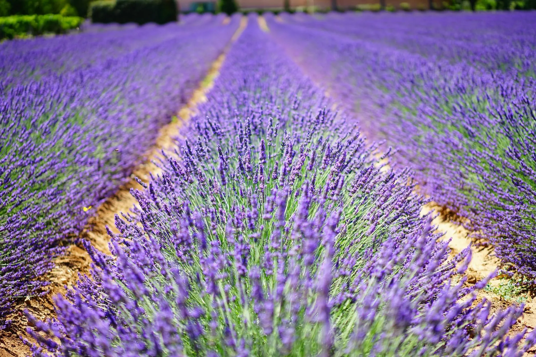
Sault starts from the plateau of the same name (altitude already 750 m), crosses the lavender fields (spectacular in July—see our article on lavender blooming), then climbs gradually via a wide, well-surfaced road. The gradient never exceeds 7-8%, and most of the route oscillates between 4 and 6%.
The final 5 kilometers join the common final switchbacks, with a gradient that steepens a bit (7-8%). But overall, Sault is the most “rolling” climb: you can keep a comfortable gear, admire the landscape, and reach the summit without giving everything.
Our take: Sault is perfect for a first climb, for less trained cyclists, or for those who want to enjoy the scenery without suffering martyrdom. It’s also the ideal climb by e-bike: you climb calmly, you pass the lavender fields, and you savor the summit without exhaustion.
Practical tips for a successful climb
Physical preparation and equipment
Ventoux is not a col like any other. The altitude (1910 m), the length (20-26 km depending on the side), and the exposure (wind, sun) make it a serious challenge. Here’s what we recommend:
- Training: if you’ve never climbed a mountain pass, train on long climbs (10-15 km) before attempting Ventoux. Work on endurance, not power: you need to sustain 2-4 hours of continuous effort.
- Bike: a triple chainring or compact (39x28 minimum) is essential. Purists climb with a 39x25, but they suffer. Brakes in excellent condition: the descent is long (20 km) and steep (8-10%), with tight turns.
- Equipment: 2-3 water bottles (it’s hot, you sweat a lot, and there’s only one fountain at chalet Reynard), energy bars, sunscreen (SPF 50), sunglasses, light windbreaker (15-20 °C / 27-36 °F difference between base and summit). A helmet, obviously.
When to climb: weather and season
Ventoux is open to traffic from around April to November (winter closure depending on snow). The best periods:
- May-June: mild temperatures (15-25 °C / 59-77 °F), little wind, uncrowded road. Lavender fields not yet in bloom, but the landscape is green.
- July-August: extreme heat (30-35 °C / 86-95 °F at the base, 15-20 °C / 59-68 °F at the summit), possible violent mistral, road saturated with cyclists, motorcycles, and cars. If you go, leave at dawn (6-7 AM) to avoid heat and crowds.
- September-October: ideal temperatures (15-25 °C / 59-77 °F), fewer people, magnificent autumn colors. Watch for wind (mistral frequent in autumn).
Check the weather the day before: the mistral can blow at 80-100 km/h at the summit, making the climb dangerous (and the descent terrifying). If forecasts announce strong mistral, postpone.
Climbing strategy: managing effort
Ventoux is won in the head as much as in the legs. Here are our tips:
- Start slowly: the first 5 km of Bédoin are easy, don’t get carried away. Save energy for the forest (km 6-15) and especially for the final 6 km (moorland).
- Find your rhythm: aim for 60-70% of your maximum heart rate in the forest, 70-80% on the moorland. If you’re in the red zone before chalet Reynard, you’ll blow up.
- Hydrate: drink every 10-15 minutes, even if you’re not thirsty. Dehydration is the leading cause of abandonment on Ventoux.
- Eat: an energy bar every 30-45 minutes. No big meal before the climb (difficult digestion under effort), but a hearty breakfast 2-3 hours before.
- Accept the suffering: the final 6 km are mentally grueling. The summit seems never to arrive, the wind slows you down, the sun beats down. It’s normal. Pedal stroke after pedal stroke, don’t think about the summit, think about the next turn.
Descent: danger ahead
The Ventoux descent is technical and dangerous. Narrow road, tight turns, steep gradient (8-10%), gravel in the turns. Every year, cyclists are seriously injured descending too fast.
- Brake before turns, not in turns. Alternate front and rear braking to avoid overheating rims (or discs).
- Stay focused: no photos, no gazing at the scenery. Eyes on the road, hands on the brakes.
- Watch for motorcycles: they come up fast, overtake in turns, and don’t always see you. Keep to your right.
- If you’re scared, stop regularly to let brakes cool and regain composure. No shame in descending slowly.
Classic mistakes (and how to avoid them)
Starting too fast
The temptation is strong to follow the pace of a group or to want to “get it over with quickly.” Result: you blow up at km 15, and the final 6 km become an ordeal. Climb at your own pace, even if it means letting others go.
Underestimating the wind
The mistral can blow at 60-80 km/h at the summit, slowing you by 5-10 km/h. On the moorland (final 6 km), a headwind can turn an 8% gradient into a felt 12%. Check forecasts (Windy.com is reliable), and if strong mistral is announced, postpone.
Forgetting water and food
Dehydration and hypoglycemia are the two main causes of abandonment. Bring 2-3 bottles (you can refill at chalet Reynard, km 15 from Bédoin), and eat regularly. No “I’ll eat at the summit”: you won’t make it.
Neglecting the descent
Many cyclists focus on the climb and neglect the descent. It’s a mistake: the descent is technical, long, and tiring (arms, hands, concentration). Check your brakes before leaving, and descend carefully.
Combining the climb with a Provence stay
Ventoux is about 50 km from Avignon (1 hour by car to Bédoin). If you’re staying with us in the Quartier des Teinturiers, here’s how to organize your day:
- Day before: light dinner (pasta, rice), early to bed. Prepare your bike, check brakes, inflate tires.
- Day of: wake 5:30-6 AM, hearty breakfast (bread, jam, banana, coffee), leave 6:30-7 AM. Arrive Bédoin around 7:30-8 AM, start climb 8 AM. Summit around 10 AM-12 PM depending on your level. Descent, lunch in Bédoin or Malaucène (terraces, restaurants), return Avignon late afternoon.
- Next day: rest, visit Avignon on foot (Palais des Papes, Halles market), massage if needed (several practices in town).
If you’re staying several days, combine Ventoux with a visit to the perched villages of the Luberon, a tasting at Châteauneuf-du-Pape, or a stroll through the lavender fields (July).
Bike and e-bike rental: making the climb accessible
Several rental shops in Bédoin, Malaucène, and Sault offer road bikes and e-bikes. E-bikes have revolutionized access to Ventoux: with electric assistance, the climb becomes accessible to everyone, even occasional cyclists. You climb calmly, you enjoy the scenery, and you reach the summit without exhaustion.
A few courtesy rules if you climb by e-bike:
- Respect traditional cyclists: don’t overtake in hairpins, give priority on climbs, don’t cut across.
- Manage your battery: a full climb (20-26 km) consumes 50-80% of the battery depending on assistance mode. Plan generously, especially if you’re descending via another side.
- Enjoy: the e-bike lets you lift your eyes, talk with companions, savor the landscape. It’s another way to experience Ventoux, just as valid.
Ventoux, more than a col: a symbol
Climbing Mont Ventoux by bike means joining a community of enthusiasts who share the same suffering, the same pride, the same respect for this stone giant. Whether you climb via Bédoin, Malaucène, or Sault, by road bike or e-bike, you’ll live an intense, grueling, and unforgettable moment.
If you’re preparing your climb and looking for a comfortable base in Avignon—50 km from Ventoux, in the heart of Provence—our apartments Lavande Évasion, Lavande Dorée, and Cinéma Provence welcome you with all the practical advice to succeed in your challenge. We know the best bike rental shops, the routes, the traps to avoid. And after the effort, you’ll enjoy the charm of the Quartier des Teinturiers, steps from the best restaurants in Avignon. Good luck, and may the road be with you!
About this article
Which is the hardest Mont Ventoux climb?
Bédoin is the toughest: 21.5 km, 1610 m elevation gain, average gradient 7.5% with sections at 10-12% in the forest (km 6 to 15). The final 6 km across the lunar landscape, exposed to wind and sun, finish off many riders. It's the legendary Tour de France climb, but also the most demanding physically and mentally.
Which side of Ventoux should I choose for a first climb?
Sault is the most accessible: 26 km, 1220 m elevation, average gradient 4.7%. Longer but gentler, it crosses the Sault plateau (lavender fields in July) before joining the final switchbacks. Ideal for a first experience or if you're not a seasoned climber. Malaucène is a good compromise: shorter than Sault, more regular than Bédoin.
When should I climb Mont Ventoux by bike in 2026?
May-June and September-October are the best periods: mild temperatures (15-25 °C / 59-77 °F), less traffic, moderate wind risk. Avoid July-August: extreme heat (30-35 °C / 86-95 °F at the base, 15-20 °C / 59-68 °F at the summit), possible violent mistral, and road saturated with cyclists and motorcycles. The summit can be closed in winter (snow, ice) from November to April.
How long does it take to climb Ventoux by bike?
It depends on your level and the side. Bédoin: 1h30-2h30 for a trained cyclist, 2h30-4h for an amateur. Malaucène: similar time. Sault: 2h-3h30 depending on level. Tour de France pros climb Bédoin in 55-65 minutes. Always plan 30 min more than your estimate: wind, heat, and altitude slow everyone down.
What should I bring to climb Ventoux?
Essential: 2-3 water bottles (there's only one fountain at chalet Reynard, km 15 from Bédoin), energy bars, sunscreen, sunglasses, windbreaker (15-20 °C / 27-36 °F difference summit/base), repair kit. Clothing: breathable jersey, quality bib shorts, gloves. Bike: triple chainring or compact (39x28 minimum), brakes in good condition (long, steep descent).
Can I rent a bike to climb Ventoux?
Yes, several rental shops in Bédoin, Malaucène, and Sault offer road bikes and e-bikes. Expect around €40-60 per day for a road bike, €60-80 for an e-bike. Book ahead in high season. E-bikes make the climb accessible to everyone, but respect traditional cyclists (don't overtake in hairpins, give priority on climbs).